

Dando Utilities Ltd can offer Ground Radar Surveys for multiple applications and uses.
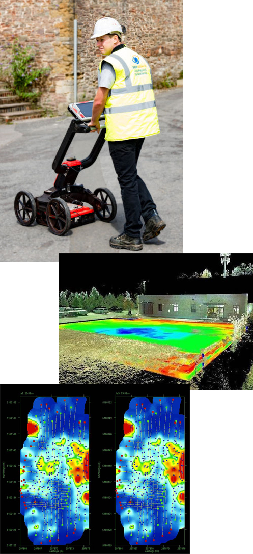
Ground Radar, also known as Ground Penetrating Radar (GPR), was originally developed for mapping geological features. It is now increasingly used in engineering projects as it offers a unique non-invasive and non-destructive means for the characterisation of subsurface features.
Ground Radar can be used on a wide variety of materials, typically soil, concrete and asphalt. General uses for Ground Radar:
- Construction Detail. Ground Radar can determine a general arrangement of underground make-up, changes in soil or material, location of structural steelwork and layer thickness.
- Concrete Mapping. Ground Radar can be used to inspect concrete floors, walls, decks, slabs, tunnels, warehouses and garages. It can locate rebar, tendons, conduits, voids and measure slab thickness.
- Roads, Runways and Pavements. Ground Radar can determine pavement thickness and detect voids underneath a road or pavement.
- Buried Objects. Ground Radar can be used to locate underground storage tanks, grave location, used in forensic investigations and locate a wide variety of other buried objects.
- Utility Service Locations. Ground Radar is the only non-destructive technology that can identify non-metallic as well as metallic utility supplies. It is suitable for the location of services including water, sewer, gas, electric, telephone and fibre optic.
- Foundations. Ground Radar is a useful tool for the location, investigation and determination of the extent of footings and foundations.
Dando Utilities Ltd experienced surveying professionals are trained to expertly interpret the results of a Ground Radar survey and supply comprehensive reports on the features located. These reports can be used in conjunction with any of our other survey services if necessary.
PAS128
We offer PAS128 surveys and reports for the highest level of Utility Mapping information.
Road Radar Surveys
Our towable multi array radar system will cover roads and motorways quickly and with minimum traffic management, causing less project disruption.
Latest Radar Technology
We use the very latest radar systems from Mala, enabling us to use post processing for the most detailed surveys.