
Dando Utilities Ltd offer an essential mapping and tracing service for projects that require site excavation, where underground obstructions such as pipes and cables may be present.
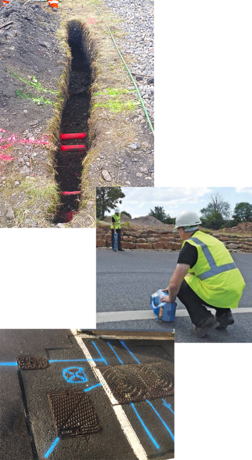
Using various non-intrusive technologies such as Ground Penetrating Radar (GPR) and electromagnetic techniques, Dando Utilities Ltd highly skilled surveyors can accurately locate and position detectable buried utilities. This is particularly important where piling and deep foundations are to be installed and where any ground penetration below the surface level is required. Underground utility surveying is both a legal requirement and of paramount importance for health and safety.
A comprehensive utility survey from Dando Utilities Ltd can:
- Demonstrate compliance with Health & Safety Regulations, protecting your employees.
- Help avoid unnecessary site excavation.
- Locate forgotten or unrecorded buried utilities.
- Identify safe locations for bore holes, trial pits and soil sample digs.
- Improve project planning and cost management, whilst avoiding unnecessary delays.
- Help avoid congested utility areas to plan new utility routes.
Dando Utilities Ltd underground utility surveying solutions have been used in various project applications including water networks, drainage, highways, military bases as well as by private and public works construction contractors.
Following a survey, a detailed utility plan along with any recommendations is prepared making development of a site more informed and safer.
As with all Dando Utilities Ltd solutions, an underground utility mapping survey can be supplied in conjunction with any of our other services. A topographical survey can also be prepared, to give an overall picture of a site both above and below ground, and our CCTV drainage surveys can offer a full condition report.
PAS128
If required, we can offer PAS128 survey reports for the highest level of Utility Mapping information.
Client Deliverables, Service & Quality
Clear and accurate survey reports can be supplied in DWG, DXF, PDF formats and many others.
Latest Technology
We only use the most current equipment, ensuring that we stay at the forefront of utility mapping